Friday, December 6, 2013
Monday, June 24, 2013
Long Time No See
We haven’t seen much of each other this year, but we have at least been able to follow each other’s lives through the media. Knut Eirik featured in the film Gollegiisa – Skattkammeret, Sara have done amazing works in graphic design at the Royal Academy of Art in The Hague, Iver and friends, has started the band Monolith House and will be playing at both Trænafestivalen and Buktafestivalen this summer, and Kjerstin has been digging herself into the world of academy and mineral conflicts with her PhD Project at AHO, a recent sideshow was a text for the wonderful project Hollow Earth by Tanya Busse and Emilija Skarnulyte.


Wednesday, December 19, 2012
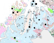
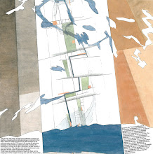
Oh Erskine, oh Erskine

see all the proposals here
Monday, December 17, 2012
"Possible Greenland" exhibition review: Hjemme i verden - hvor ble det av den kritiske revy?
«Possible Greenland» fortæller historien om geologiske dannelsesprocesser i fortiden og om en mulig fremtid for landet som resurseleverandør i en ny geologisk æra – antropocene – menneskehedens tidsalder. Med en forventning til de muligheder, klimændringerne kan åbne for i nord, bliver publikum forklaret, at storskala industriudvikling vil kunne muliggøre etablering af nyt erhvervsliv og en ny urban kultur. Nutiden og den nære fortid bliver kun berørt lidt.
Artikkelen i Sermitsiaq er oversatt til grønlandsk og dansk, og den tar for seg på hvilken måte Dansk Arkitektur Center har gått inn i geopolitikken. Utstillingen ble vist på den 13. Arkitektur Biennalen i Venezia i 2012 og skal vises i Nuuk i 2013.
.JPG)
Friday, June 29, 2012
Kiruna debatterer

”Våra samhällen lever och andas med gruvindustrin.
Då ska också invånarna få verktygen att ta ansvar och planera för framtiden.
Det är inte konstigare än att en metallarbetare behöver maskiner för att forma
sina detaljer, eller att en arkitekt behöver skissblock och dataprogram.
En arkitekt med intressanta åsikter om just
detta är professorn Knut Eirik Dahl. Han har på uppdrag av norska regeringen
undersökt förhållandet mellan gruvorna och samhällena i Barents och presenterat
slutsatserna under rubriken Fields
of Exploration – Limits of Exploitation (ungefär ”Utforskningens
fält – Exploateringens gränser”).
Flott at vårt master studio landskap ved AHO sine kunnskaper brer seg ut, bloggen studeres vidt og bredt.
Det rommer av og til små feiltolkninger, også noen oppmuntrende. Vi skulle gjerne sett at det var den norske regjeringen som ga oss oppdraget, men slik var det jo ikke. Selv om Utenriksdepartementet deltok meget aktivt og kunnskapsrikt på den første workshopdagen i vårt studio.
Friday, May 25, 2012
Fields of Exploration, Limits of Exploitation
For å få utsagnskraft i forhandlingen om framtiden må arkitekturen med
sine verktøy agere i den delen av nåtiden der framtiden er i spill. Gjennom 9
hektiske vårvinteruker, der informasjon om raske endringer i det globale og
økonomiske mineralbildet hele tiden kom strømmende mot oss, gjorde studioet
sammen med 20 eksperter i feltet en oppdagelsesreise i overlappingen mellom
forskjellige kunnskapsområder som angår mineralindustrien. Gjennom temaene Det store bilde, Det Perforerte Landskap,
Det flerprogrammerte Landskap, og en samling av individuelle Refleksjoner utforsket studioet hvordan
en ny versjon av Nord-Norge er i ferd med å bli unnfanget, kartlagt og
beskrevet gjennom nasjonale tiltak og strategier for resursutvinning. Det oppdaget
hvilket mulighetsrom Regjeringens kommende mineralstrategi bereder grunnen for
og hvilket press dette legger på kultur og landskap.
The 9 week studio took off from the global appetite
and dependency on metals and minerals, and related it to national initiatives
and strategies for mineral extraction as they now are in the making in Northern
Norway. During 2012 the Norwegian government will present its own mineral strategy.
The studio aimed to unfold the social, legal and environmental implications of
an increased extraction seen through the lenses
of the landscape architect. Through the themes The Big Picture, the Perforated Landscape, the Multi Layered Landscape,
and a collection of individual Reflections
the studio discovered how a new version of the territory are being mapped,
described and conceived. Mining doesn’t only
denote big profits; its industry also entails large scale impacts on landscape,
nature and society. The notion of actuality, on taking part in the debate and
acting in the world while things are happening discusses the landscape
architects agency in taking part in the shaping of futures.
DET STORE BILDET
Studioets første fase fokuserer på kartlegging av gruvedriftens globale systemer gjennom å bygge opp et atlas. Vi studerer drivkreftene bak gruvedrift, det økende ressursforbruket, mineralnæringens globale nettverk og infrastruktur og ser på hvordan dette utspiller seg i sirkumpolare områder.
and infrastructure and how this plays out in the circumpolar areas.
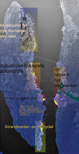
DET PERFORERTE LANDSKAPDen andre fasen bygger opp en katalog over gruvedriftens innvirkning på landskapet, nye geologiske undersøkelser, forskjellige typer gruvedrift, livssyklusen til en gruve og kortsiktige og langsiktige miljøpåvirkninger.
The second phase creates a catalogue on mining’s impact on the landscape, study new geological surveys, modes of mining, the life cycle of a mine and mining’s environmental impacts.
DET FLERPROGRAMMERTE LANDSKAP
Denne fasen vil vi undersøke virkningen av gruvedrift på lokalsamfunn, den
overlappende arealbruk, lovverk og urfolksrettigheter og konkurrerende landskapsbruk
ved å lage et magasin med kronikker.
ved å lage et magasin med kronikker.
Open publication - Free publishing - More exploitation
THE MULTILAYERED LANDSCAPE
In this phase we will examine the impact of mining on communities, the indigenous dimension, the overlapping use of land, legislation and competing activities by making a magazine of chronicles.
REFLEKSJONER
Basert på kunnskapsinnhenting, studiereise, samtaler og workshops med kursets lærere og eksterne eksperter formulerer studentene sine refleksjoner sammensatt av de kunnskapene som er tilført studioet. Kolleksjonen viser bredden, dybden, muligheten og konsekvensene av dette nye nasjonale initiativet i Nord-Norge.
(some reflections had big filesizes, so we had to divide the collection into 3 e boks)
Open publication - Free publishing - More exploitation
external experts, the students formulate reflections composed of the knowledge acquired during the studio. The collection shows the breadth, depth, possibilities and impacts of this new national initiative in Northern Norway.
Sunday, February 5, 2012
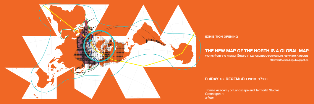
Who builds the map?
On our journey in Spain in November, Pilar Pinchart was present at our lecture at ETSAM in Madrid invited by Juan Herreros. In the discussion after the lecture Pilar was very interested in the notion "The New Economical Landcape". The day after we had a conversation on this topic, and more, at the beautifull space in Hotel de las Letras in Madrid.
See also a series of other interviews by Architect Pilar Pinchart at tv skfandra! Hans Ulrich Obrist, Abalos + Sentkiewicz, Florian Beigel+ Phil Christou, Anton García-Abril, Reiner de Graaf, Juan Du + Chad Mc Kee, Peter Barber, Stefano Rabolli...
CLOSEUP: DAHL & UHRE from skfandra on Vimeo.
Monday, January 16, 2012
La Byen Synges
Når bystyret i Tromsø trakk søknaden om innlemmelse i Samisk språkområde, mistet vi en viktig mulighet til å befeste et viktig kulturelt lag i våre offentlige rom; til å tilføre en kompleksitet som skaper møter mellom mennesker og fortellinger. Tromsø gikk glipp av muligheten å formidle at byen anerkjenner at den er et sted hvor to verdener møtes.
Nye visuelle språk og ideer oppstår i kampsonene. I høst har vi sett New York gallerier plukke opp Occupy Wall Streets «scruffy cardboard signs» og 15-M bevegelsens visuelle språk bli brukt i Vodafones mobilabonnementskampanje. Vi har sett vrengte kofter. Protestaksjoner er en del av vår kulturelle produksjon og blir etter hvert plukket opp av reklamebransjen, mote, film og kunst.
Tromsø kan ikke kreve av de samiske miljøene at de alltid skal måtte hente den kreative energien i kampen for rettigheter og synlighet - en synlighet som Norge og Tromsø markedsfører for alt den er verdt.
les mer i Nordlys 12.01.2012 :
Oslo 26. Januar: POP UP // Nordic Architecture Award
OAF starter forelesningsrekken 2012 med fire forelesere og presentasjon av vinnerprosjektene fra the Nordic Architecture Award 2011 :
Journalist Mark Isitt (sverige) starter foredraget med en kort presentasjon av Nordic Architecture Award og avslutter med en oppsummering og om tendenser i nordisk samtidsarkitektur.
En av målene til Oslo Arkitektforening er å nå lengre ut til folket med arkitekturen og vi tar i bruk nye steder i Oslo by til OAF-foredrag i 2012.
Første sted ut er Deichmanske hovedbibliotek på Hammersborg - VELKOMMEN!!

Snøhetta (norge)
Beste bygning: Reinsdyrpaviljongen i Dovrefjell nasjonalpark/ Norge.

Landslag (island)
Beste offentlige rom: Byrom ved Harpa konserthus i Reykjavik/ Island.

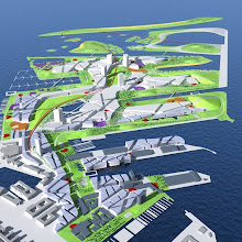
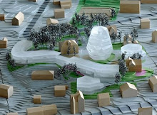
Dahl + Uhre (norge)
Beste byplan: Nunarsuup qeqqani / Nuup qeqqani // In The Middle of the World / In the Middle of NUUK
- Grønland
Subscribe to:
Posts (Atom)