Wednesday, May 27, 2009
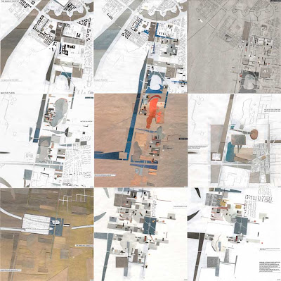
Gaza damage assessment overview // UNOSAT // link // The Map Collection
Labels: in english, The Map Collection
Tuesday, May 26, 2009
Kronikkenes by II - Tromsø 2040 #2
 Nordlys åpner i en periode fremover kronikksidene for tekster om forskning innen energi, marine ressurser, kultur, næring og utvikling i nordområdene. Peter Holm og Bjørn Eirik Olsen's kronikk om Marin sektor frem mot 2040, tirsdag 26.5 er den andre i denne serien.
Labels: in norwegian, media, Tromsø
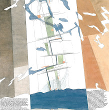
D&U ONLINE PAPERS // Appearing and disappearing Landscapes
D&U ONLINE PAPERS // Appearing and disappearing Landscapes
Labels: in english, landscape, ONLINE PAPERS, urbanism
Monday, May 25, 2009
NATURBASE // link // The Map Collection

Områder som er vernet, eller foreslått vernet, etter naturvernloven, Svalbardloven, Svalbardmiljøloven og viltloven // Naturtyper og arter som er viktige for å opprettholde mangfoldet i naturen. // Arter som har spesiell betydning for jakt og annen høsting. // Kulturlandskap med viktige biologiske og/eller kulturhistoriske verdier. // Friluftslivsområder som er sikret for allmenn bruk ved at staten har kjøpt dem eller skaffet seg spesielle rettigheter i dem. // Motorferdselsreguleringer, reinsjaktområder, ilandstigningsplasser m.m. på Svalbard.
I Sverige finnes en naturkartbase organisert av lansstyrelsene, for Skåne heter den Naturguiden med viewer.
Den tilsvarende naturkartbasen for Danmark er: Miljøportalen med arealinfo.
Labels: in norwegian, landscape, The Map Collection
Sunday, May 24, 2009
Turliv på yttersia // The Map Collection
 På Bent Svinnung's interaktive kart som finner du lenker til noen av hans favorittplasser, fra Helgelandskysten til yttersia av Troms, samt en del informasjon om beliggenhet, tilgjengelighet, praktiske tips, historikk. Jeg har stor glede av å klikke på de hvite punktene på dette kartet og studere turbeskrivelser og se fantastiske bilder. Yttersida av Troms er et eldorado for dem som bedriver turliv, uansett om framdriften skjer med åre, seil, motor eller beina. Masse rullesteinsfjærer, sandstrender, holmer og skjær, egger og vegger. Nok til å ta pusten fra de aller mest blaserte.
Turliv på Yttersia,
Labels: in norwegian, landscape, The Map Collection, Tromsø
A walk through H // link // The Map Collection

"A walk through H: The Reincarnation of an Ornithologist " by Peter Greenaway is a 40-minute abstracted journey film, told almost entirely through the use of a series of 92 maps, - A friend of mine showed me this short film when I was studying architecture at BAS in early nineties and it is still one of my favourites. The film is "set" entirely in the world of "H," which is represented only by Tulse Luper's maps, sprinkled with occasionally intercuts with images of birds and sunsets. The panning along the paper surfaces of the imaginary maps is intriguingly fascinating and so is the narrator’s absurd dry voice describing how he came to possess each of these maps, and what his journey is like.
At the official website, petergreenaway.org.uk you can read Greenaway’s own idea about A Walk through H: "I've always been fascinated by maps and cartography. A map tells you where you've been, where you are, and where you're going - in a sense it's three tenses in one. It's also an amazing ideogram of information that is very useful and, perhaps most pertinently, also not at all useful. My father had recently died, and the subtitle of the film was 'The Reincarnation of an Ornithologist' - my father was one. Through his life he had amassed an extraordinary amount of information about bird study, and I was very aware that with his death - as indeed with any death - a vast amount of very personalized information had gone missing, was totally irrecoverable. The film is on the journey a soul takes at the moment of death, to whatever other place it ends up - H being either Heaven or Hell. I devised 92 maps to help this particular character get there. The whole film was divided into five sections that represented movement from a very urban landscape to a wilderness landscape, and there were references and cross-references to all sorts of systems."
Follow this link to A Walk Through H: The Reincarnation of an Ornithologist
Labels: in english, The Map Collection
Saturday, May 23, 2009
Most complete Earth map published // link // The Map Collection
I found information about GDEM at The Map Room, Jonathan Crowe's intriguing and daily updated blog about maps.
Labels: in english, The Map Collection
Friday, May 22, 2009
RADIO RADIO
 Kai Sibbern i Verdibørsen, P2s magasin for etikk og livssyn har lest Knut Eirik Dahls leder i tidsskriftet Marg om byen, med tittelen Byen under press, og har tent på denne. Idag intervjuet han Knut Eirik i 15-20 minutter som sendes i helgen. Marg er ute av trykkeriet i dag!
Labels: dialogue, in norwegian, media, urbanism
Thursday, May 21, 2009
D&U ONLINE PAPERS // The Magic Carpet

"The urban ideals loom larger than the understanding of landscape, shining far more brightly as it were. The borders of urban space constitute an intellectual hinterland. The relation between what is built and the continued life of the landscape is destined to remain the major theme in the civic space of the future...."
D&U ONLINE PAPERS // The Magic Carpet, 1994
In 1994 we participated in the international competition for the expansion of Copenhagen, called Ørestaden. The project received the second prize in the competition. The idea universe of the project is duly published in the periodical "byplan" No. 5, 95. Through the presentation of the project's own text and a comprehensive critical review of the competition by Professor Jens Kvorning (jury member). The concept launched "The Game of Ørestaden" by setting up the structure plans as a set of playing pieces, in which different forces of change led to entirely different interpretations of this future urban landscape. The current development in Copenhagen, where other areas have come into the searchlight and are taking power from the "ideal" Ørestaden, confirms one of our statements in the competition - "The spirit of the place is bound to be found elsewhere".
Labels: in english, landscape, ONLINE PAPERS, urbanism
Wednesday, May 20, 2009
D&U ONLINE PAPERS
This week we will start a new series at the blog: D&U ONLINE PAPERS. Here we will make available a selection of texts, papers and lectures for download.
Labels: dialogue, in english, ONLINE PAPERS, publication


