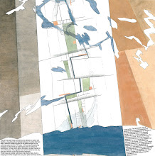
 Yesterday two of our friends tipt us simultaniously about a blogpost on BLDGBLOG about Inuit tactile maps of the Greenland coastline. Marianne Skjulhaug called from Bergen and Ross Langdon sent a mail from Uganda (!). Follow the link and learn more. It is truly intriguing.
The carving is 300 years old and shows the coastline with fjords, islands, nunataks and glaciers. The outline of the coast is carried up one side and down the other.
Later today, Aviaaja and Helena from tnt nuuk is coming to stay the week in Tromsø on our 3'rd workshop about Nuup Qeqqani. We are sure they can tell us more about these maps and maybee we can see them for ourselves the next time we go to Nuuk...
Sunday, February 21, 2010
WOODEN CARVED MAPS IN CYBERSPACE
Labels: Greenlandos d'Amour, The Map Collection
Subscribe to:
Post Comments (Atom)


Incredible objects both mysterious and rational at the same time.
ReplyDeleteI wish I could be with you in Tromsø this week.