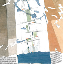
This screenshot of the MAREANO map viewer shows the area of hydrographic survey data at the Norwegian continental shelf, an area bigger than the Norwegian mainland. On the MAREANO map wiever you click into registrations, images and videos of the seabed.
Global heating increases the pressure on coastal areas and ocean zones, the seabed itself and the quality of the ocean areas are at stake – the resources here constitute the world’s future "granaries" and "larders". It is the mapping and change of this seascape that now appears as the big challenge – a future and appearing landscape undergoing a dramatic and complex process of change. This environmental mapping’s collision with the mapping of fossil resources can from hegemonic milieus be seen as a disturbing mapping.
MAREANO maps depth and topography, sediment composition, biodiversity, habitats and biotopes as well as pollution in the seabed in Norwegian coastal and offshore regions.The MAREANO Programme aims to provide answers to questions such as: How is the seascape of the Norwegian continental shelf? What does the seabed consist of? How is the biodiversity distributed on the seabed? How are habitats and biotopes distributed on the seabed? What is the relationship between the physical environment, biodiversity and biological resources? How are contaminants stored in sediments? MAREANO is coordinated by the Institute of Marine Research, in collaboration with the Geological Survey of Norway and the Norwegian Hydrographic Service.The Programme is financed by the Ministry of Fisheries and Coastal Affairs, the Ministry of Environment and the Ministry of Trade and Industry via contributions from the National Budget.
Se også Forvaltningsplan Barentshavet og havområdene utenfor Lofoten og Helhetlig forvaltning av det marine miljø i Norskehavet
Norwegian Journal of Geology – online:
Sediment characteristics and environmental implications
in the Lofoten - Barents Sea region
"In this issue of NJG we present papers focusing on (sub-) recent geological and biological characteristic of the Lofoten - Barents Sea region. This theme covers a wide range of studies ranging from large-scale submarine landscape evolution to small-scale biological diversity. A common aspect of most papers is the attempt to describe the interaction of geological and biological processes in the Lofoten - Barents Sea region and the implications these have for environmental changes. Most of the research has been performed under the umbrella of the MAREANO (Marine AREal Database for NOrwegian Waters) program, its first phase from 2005 to 2010 being funded by the Norwegian Government." Read the articles here: NJG 2009 Volume 89 Nr. 1 & 2
...men forskere får ikke miljøkartlagt havbunnen utenfor Lofoten før regjeringen skal vurdere oljeboring.... "I 2004 opprettet myndighetene havforskningsprosjektet Mareano. Mareano skulle kartlegge biologisk mangfold på havbunnen i nordområdene. Men på grunn av lave bevilgninger over mange år, blir ikke prosjektet ferdig. Blant annet vil ikke Nordland 6 bli kartlagt i det hele tatt." Les mer i Hundre millioner mangler (Dagbladet 17.8.2009)
Nyhet 10.09.09: Arbeidet med de 17 første områdene i Nasjonal marin verneplan er i gang. Planen er den første i sitt slag for å verne undersjøisk natur.Les mer her:Skal verne natur under vann
Sweeden has enviromental informaton on their coastal areas at this page: Havsmiljøn and on the viewer Vattenkartan
See also: The EU Water Framework Directive and Breathless coastal seas, and for the Baltic Sea:
WWF: Baltic Ecoregion Programme
Documentary on cod fishing in the Baltic Sea
Thursday, May 28, 2009
Mapping the Seabed // MAREANO // link // The Map Collection
Labels: in english, The Map Collection
Subscribe to:
Post Comments (Atom)


No comments:
Post a Comment