

Uncertainty in the larger geography and time.
In the contest program the development of Nordhavnen is motivated by Copenhagen’s future increase in population, and by the fact that other areas are filled up faster than one thought prior. The program’s dialogue is limited to other closely located development zones as Ørestaden, the Carlsberg area and Kløvermarken. Nordhavnen must be explored and developed in a larger picture, where both the global as well as the regional context are at work. The idea of the Øresund region opens for an image where Nordhavnen enters into a dialogue with events and developments in a geographically larger region; in Malmö with Bo01, the new metro and the urban development project in Hyllie, and in Helsingborg with the development of Norra hamnen and H+. There is a kind of conversation, if not an exchange, between these initiatives as markers in the possible future metropolis image of Øresund. There is every possible reason for developers and developing constellations to look aside.
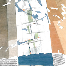
This Map (and text) is from the 1st price project in Nordhavnen, (1st face), Copenhagen: Excentral Park - Edge Dynamics, which we did together with 70°N and a panel of experts.
This Map (and text) is from the 1st price project in Nordhavnen, (1st face), Copenhagen: Excentral Park - Edge Dynamics, which we did together with 70°N and a panel of experts.


No comments:
Post a Comment