

This map was our starting point for an investigation on a city development in Stavanger in 2000. It led, together with Paolo Viganos lecture in Cordoba (Europan, 2003) to the text ”Topografiske attraksjoner” (topographical attractions), published in Arkitektnytt in 2003.
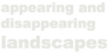
In the spring 2010 we will revisit the study field of Jæren through the course, Appearing and Disappearing Landscapes, which is part 2 of AHO's "Research on the Norwegian Landscape". The course is an inter-Nordic cooperation between the AHO and Forests and Landscape at Copenhagen University. Jæren is a region that today has the largest urban growth in Norway after Oslo. The region, which is the centre of oil development in Norway, is now entering into a new phase, causing both landscape and urbanity to be in need of reinterpretation. The course will establish recognition on the larger scale that will affect knowledge built up during the course work. The UN climate conference, COP 15, in December 2009 will send out signals concerning this larger scale.
The Course is planned as a discourse between landscapes and urban conditions that range from the smallest biotope to the larger future image. Students will throughout the semester work on individual projects as experiments in the relationship between different territorial contexts and urban strategies; this will entail both a smart and innovative cartography and conceptual design projects.
Monday, June 15, 2009
Why Here? // The Map Collection
![]()
Subscribe to:
Post Comments (Atom)


No comments:
Post a Comment